


Presentation
Discover Route No. 7 – Trail de l'Étendard – from the Espace Trail Pays des Aiguilles d'Arves.
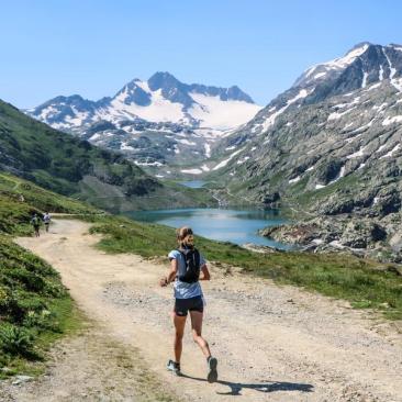
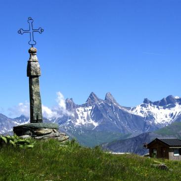
From the Tourist Office of the village of Saint Sorlin d'Arves (alt.1500m), this double loop route will make you to discover exceptional landscapes, in a resolutely alpine setting. You will start with a climb to the Ouillon, the highest pasture in Europe. You will discover a 360 ° panorama with the Mont Blanc range, the Aiguilles d'Arves and the Belledonne massif as a backdrop. You will then descend to the Col de la Croix de Fer before continuing to the Col Nord des Lacs by the eastern massif des Perrons. You will then discover the Bramant Lake, then the White Lake, which you will follow before joining the Refuge of Etendard. The time for a short break ?Then you go back to the Col des Tuffs before descending to the Col de la Croix de Fer and the village of Saint Sorlin d'Arves. This course is proposed during the Trail of the Etendard, last weekend of July.
Routes available on the Espace Trail Pays des Aiguilles d'Arves website: https://espacestrail.run/en/paysdesaiguillesdarves/parcours/72135
Opening period
From 15/06 to 15/09 daily.
Subject to favorable snow and weather conditions.
Tarifs
Free of charge.
Equipements
Services
Activities
To download / to see
See also