


Presentation
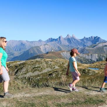
A beautiful hike in the heart of the Sybelles mountain pastures, on one of the highest grassy summits in Europe.
At an altitude of over 2400 metres, enjoy a 360° panoramic view of the Arvan valley, the Belledonne mountain range and the Ecrins massif. After wandering through a wide variety of landscapes, from Alpine hamlets to abandoned mountain huts and vast alpine meadows, you can take a well-deserved break at the top of France's 4th largest ski area. On sunny days, you'll even have the chance to see Mont Blanc in the distance!
Detailed route
From the Saint Sorlin d'Arves Tourist Office, follow the road towards La Ville, then turn left towards L'Ouillon via the Côte Ras, Praz-Bel, Alpage de Prabel, Sur le Chait, Le Torret, Plan de L'Ouillaz and Derrière les Envombres crossroads. Then continue up the path that leads to the ridge to reach L'Ouillon. From the summit, stay on the ridge and descend towards Les Chansures. From here, follow the signs for St Sorlin via Le Truchet, Lac Laitelet, Le Verrou, Cufférent and then Pierre Aiguë. Return to the starting point via Centre Village.